April is decision time for all recreational boaters in Mexican waters.
Boating conditions are probably delightful right now in April wherever you are, so soak it up because we know summer is starting to creep up from the tropics, and once hurricane season begins, that changes everything for everyone. If we discuss, consider and decide on our summer options now, then during May and/or June we can relax and begin migrating toward whichever delightful summer destination we’ve picked – not in a blind panic but in nonchalant cruiser style.
Do you remember those plans you discussed during your delightfully lazy winter cruising season? It’s time to pull out the charts and firm up some plans to travel safely and avoid hurricanes. How much time you have to get wherever you’re going for the summer depends on whether your boat is a go-fast sportfisher or a go-slow cruising trawler— whether you’re a go-slow cruising sailor or a splash-in-and-out trailer boater.
GO ELSEWHERE or STAY IN MEXICO
The first decision is whether to summer over somewhere within Mexican waters or to take the boat elsewhere. Migrating elsewhere could mean embarking on a Baja Bash, i.e. taking the boat north up the outside of Baja. Summer safety can be found in Ensenada or in any U.S. West Coast or Canadian waters. Many active cruising boaters do migrate 2,200 n.m. annually – summering over in the Pacific Northwest or Alaskan waters – then wintering in sunny Mexico.
On the other hand, vacating Mexico’s hurricane alley could mean heading south of the Gulf of Tehuantepec. Why? Because most Eastern Pacific hurricanes are birthed offshore right there and then move northwest. Hundreds of boaters in the Panama Posse group depart Barra de Navidad in spring, in time to zip safely past Tehuantepec before hurricane danger builds. Hurricane-free cruising in Costa Rica and the Panama Canal lure them south. I
Next issue of the Log, I’ll share my experiences and those of others with migrating south out of Mexico before summer. But for now, let’s consider staying in Mexico and examine the pros and cons of the different places and methods to summer over safely down here.
SUMMER IN MEXICO
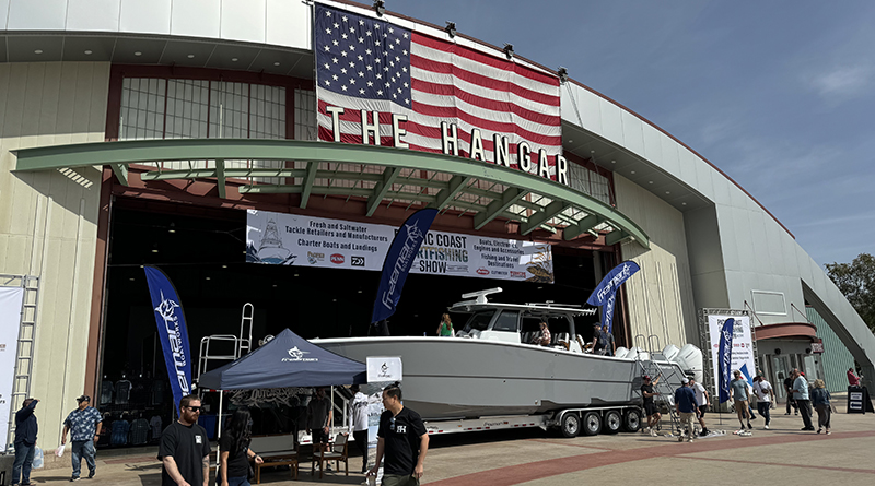
I interviewed Doug and Pauline at a boat show. “Summering over in Mexico was great,” Doug said. “Fishing and diving were great around Mazatlan. Not so many tourists. Our marina had power enough that we ran our air conditioning whenever we needed it, which was often.”
Then Pauline said, “Yes, we enjoyed it until Hurricane Orlean started heading our way. That definitely freaked us out.”
“Oh, right. We got the boat hauled out pretty quickly, thank God,” said Doug. “That was the end of September. We got mucho lucky.”
October 3, Hurricane Orlean’s eye slammed ashore just south of Mazatlan. But what if Doug and Pauline hadn’t been able to get their boat hauled out in time? What if Mazatlan had taken a direct hit, as it has in previous years? Mazatlan is wide open to the Pacific, not a strong hurricane hole.
HURRICANE HOLES?

Honestly, there is no such thing as a hurricane hole, especially as our planet warms and storms intensify. No spot is immune, but historically some spots in Pacific Mexico have shown less risk of damage to yachts. Despite this wary view, we do still think of a few spots as “hurricane holes.” I think it’s safer to summer over within an 8-hour voyage to one of them and keep a close eye on the NOAA storm reports.
Puerto Peñasco: As of April 2025, the eye of a named hurricane has never hit this far north in the Sea of Cortez, but remnants of depressions have occasionally swept ashore here.
This tiny fishing harbor is tucked behind a 3,900-foot headland, but its tidal range (23’ at springs) can leave anchored boats swinging too closely together or berthed on the mud. So, dozens of boats opt to haul out each summer at Cabrales Boatyard & Dry Marina using 50-, 100-, 150- and 300-ton Travelifts and five acres of paved storage yards. This pleasant beach resort town has good provisioning and is only 60 miles from the Arizona border crossing at Sonoyta-Lukeville.

The Cabrales Yard is a very popular summer haul-out for cruising boats (and some trawlers and sportfishers) whose owners don’t want to return to the US each year.
Puerto Don Juan: Located on the Baja Norte side of the Sea of Cortez six n.m. east of L.A. Bay village, Puerto Don Juan (28°57.103’N, 113°26.591’W) is a blessedly enclosed, uninhabited and undeveloped natural bay. Its narrow entrance channel has two dog legs that shield the inner anchoring basin from storm seas. Although the interior is only a quarter-mile square, I’ve seen 30 yachts and two shrimpers anchor in here when a September storm threatened. But until storm warnings go up, you can chill out at 12 uninhabited islands with lots of pristine anchorages within 12 n.m.
San Carlos, Sonora: Along with Guaymas, below, these neighboring towns each has two marinas tucked into tight little hurricane holes.
First, San Carlos is a gringo resort village with Marina Real and Marina San Carlos, both with ample yacht services. Boats anchored outside the marinas didn’t fare well in summer storms or chubascos. However, Marina San Carlos’ dry storage yard located a mile inland is called Marina Seca, a very popular spot to leave a boat “on the hard” throughout Sonora’s scorching summer – and fly home.
Guaymas, Sonora: Pronounced WHY-mass, this is a ranchero town built around a tight commercial harbor. The more expensive dry storage yard at ASIPONA Marina Guaymas has concrete floors, good security, and is near downtown. Marina Guayas on the south side of the bay is less expensive because it is a bit remote and has dirt or asphalt floors. Yet it has expanded due to its popularity with cruising sailboats.

Puerto Escondido, BCS: The Spanish dubbed this enclosed bay a Hidden Port, thanks to overlapping hills blending with the Sierra La Giganta’s 3,000-foot peaks perfectly cloaked its south-facing entrance channel. Those geologic features also shield boats inside from hurricanes, thus Marina Puerto Escondido’ hurricane-hole status as the safest choice in this mid region. Located 15 n.m. south of Loreto, the marina has 150 full-service slips, 90 moorings, fuel dock, concrete floored dry storage yard with 50-T Travelift. Palms, private channels and nice amenities attract long-term boaters willing to pay the higher slip prices.

La Paz: Here again are two good choices. First, Marina CostaBaja offers this region’s best hurricane shelter, thanks not only to its beefy breakwaters, but also because both its yacht basins are tucked into a corner steeply surrounded by hills that form the spine of the La Paz Peninsula. Ditto for Marina Palmira, located 2 n.m. down the La Paz Channel. Access is excellent to yacht services, provisions, bus and airport. Four more marinas are in town.
Puerto Vallarta: Tucked into the sheltered northeast corner of Banderas Bay, none of Puerto Vallarta’s four marinas and two boat yards has ever been hit by a hurricane eye in 190 years of meteorological history. Why? Look at the chart. The 700’ Sierra del Cuale effectively blocks the wind of counter-clockwise spinning hurricanes coming up from the south. So far, no hurricane has turned hard right and entered Banderas Bay. However, in October 2023 torrential rains from Cat 4 Lidia did flood parts of Puerto Vallarta city.
Ensenada: At latitude 31°51’ North, Ensenada is the farthest north of these potential hurricane holes. Located 60 miles south of the U.S. border, Ensenada’s three major marinas, two haul-out yards and ample tourist delights are enough to keep boaters pacified for several months. But Hurricane Hillary in 2023 hit San Quintin only 140 n.m. south of here.
Next time in July, we’ll look at what’s new and exciting in three favorite hangouts for active sportfishers and laidback sail cruisers. Hasta luego, yatistas.


