A reliable backup navigation plan can make all the difference when electronics fail off the Southern California coast.
For most Southern California boaters, today’s navigation begins with a screen.
Whether it’s a multifunction display at the helm, a tablet mounted beside the wheel or a smartphone running a marine navigation app, GPS technology has transformed the way recreational boaters travel offshore. Routes can be planned in minutes, hazards appear on digital charts, and precise positions are available with a quick glance.
But experienced captains agree on one important point: no electronic device is infallible.
Power failures, software glitches, dead batteries, water damage and even simple user error can leave boaters without the navigation tools they rely on most. While modern GPS units are remarkably dependable, having only one means of navigation can quickly turn a routine trip into a stressful situation.
For Southern California boaters making the crossing to Catalina Island, running offshore to Tanner or Cortes banks, fishing San Clemente Island or simply cruising outside the harbor, redundancy isn’t just good practice—it’s an important part of safe boating.
A backup navigation plan doesn’t have to be complicated or expensive. In many cases, it simply means carrying multiple ways to determine your position if your primary system becomes unavailable.
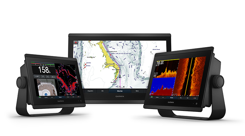
For most vessels, the fixed-mounted chartplotter serves as the primary navigation system. Connected to onboard power and often integrated with radar, sonar and AIS, it remains the most capable navigation tool aboard.
The problem arises when boaters assume that one chartplotter is enough.
Electrical issues can disable an entire electronics network. A failed battery switch, blown fuse or dead starting battery can instantly leave a boat without power. Even if the engine continues running, navigation electronics may not.
That’s where a secondary GPS source becomes invaluable.
Many experienced boaters carry a handheld GPS unit stored in a dry bag or emergency ditch kit. Unlike permanently mounted electronics, handheld units operate independently on replaceable or rechargeable batteries and can continue navigating even if the vessel experiences a complete electrical failure.
Modern marine navigation apps have also become an excellent backup resource. Applications such as Navionics Boating, Aqua Map and Garmin ActiveCaptain allow boaters to download charts directly to a smartphone or tablet before leaving the dock.
The key, however, is downloading charts in advance.
Cell service becomes unreliable surprisingly quickly once boaters leave the mainland. While Catalina Island generally has coverage near Avalon and Two Harbors, many coves and offshore areas do not. Boaters traveling farther offshore toward San Clemente Island or the outer banks may lose service entirely.
Offline charts allow a mobile device’s built-in GPS receiver to continue displaying the vessel’s location without requiring a cellular connection.
Of course, smartphones introduce another challenge: battery life.
Running GPS continuously can quickly drain a phone or tablet, particularly on longer crossings. Carrying a fully charged power bank, a 12-volt charging cable or a waterproof charging system helps ensure mobile devices remain available when they’re needed most.
Many experienced cruisers also recommend keeping backup electronics in waterproof cases or dry bags. Saltwater, spray and unexpected rain can quickly disable an otherwise functional phone.
Despite advances in electronics, paper charts continue to earn a place aboard many cruising boats.
A printed chart of Southern California waters won’t lose power, freeze during a software update or stop working because of a cracked screen. Combined with a handheld compass and a basic understanding of chart reading, paper charts provide another layer of redundancy that has guided mariners safely for generations.
Knowing how to use those charts remains equally important.
Understanding buoys, chart symbols, compass headings and basic dead reckoning can help boaters continue navigating even if every electronic device aboard stops working.
Before every trip, boaters should also verify that navigation software and charts are current. Marina entrances, aids to navigation and underwater hazards can change over time, making outdated charts less reliable.
Simple habits can also prevent unnecessary problems. Confirming electronics power up before leaving the dock, checking battery levels, carrying charging cables and reviewing the day’s route before departure all help reduce surprises once underway.
Ultimately, the goal isn’t to replace modern GPS technology. Today’s chartplotters, mobile apps and navigation software have made boating safer and more accessible than ever before.
The goal is ensuring that if one system fails, another is ready to take its place.
When boating offshore, especially on crossings to Catalina Island or longer trips along the Southern California coast, having a backup navigation plan provides more than convenience. It provides peace of mind.
Because the best navigation system isn’t the one with the biggest screen — it’s the one that’s still working when you need it most.