")
Insights from PredictWind Meteorologist, Arnaud Monges:
How to spot the differences between clouds for quick safety decisions.
There are two basic types of clouds: Cumulus and Stratus. Simply speaking, if you can count the clouds in the sky, those are cumulus clouds. They are puffy and look like a cauliflower.
If you can’t count the clouds in the sky, this is because those clouds aren’t well separated, and they tend to form a layer (big mass in the sky). This is called Stratus.
Whether or not clouds are associated with rain is very important, because it changes the wind around it — a factor important to boaters. When there’s precipitation (a cloud is raining), we add “nimbo” to the cloud’s type name as a prefix or suffix; therefore those clouds are called cumulonimbus (cumulus cloud which is precipitating) and nimbostratus (stratus cloud which is precipitating).
When a cloud isn’t raining, the wind usually moves toward it, but when a cloud is raining, the wind tends to move away from it. Knowing this simple rule can help you predict changing conditions when out on the water.
Why human observation is a non-negotiable backup to tech
Weather forecasts, like the one for PredictWind, are indispensable for boaters However, weather forecasts have some limitations. They can generally forecast cloud cover, but they can’t tell you if there’ll be a developing cumulus cloud at 2:00 p.m. on the starting line where your sailing race starts. Looking at the sky and clouds provides the sailor with real-time weather information that complements weather forecasting technology. Watching the clouds helps you understand what’s happening right where you are.
The forecast is like the general story of what will happen on the water for the day. Looking at the sky will help you tune this story to match the actual weather conditions.
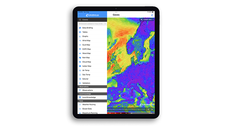
Breakdown of PredictWind’s key safety tools/features for safer boating
PredictWind is the most advanced marine weather platform available today for sailors. Here are some of the best weather technologies we offer.
- Weather models: PredictWind has some of the highest-resolution weather models in the industry, with options as fine as 1 kilometer resolution. These models include PredictWind’s proprietary PWG 1km and PWE 1km forecasts. We also offer several global weather models such as ECMWF, GFS and UKMO. Finally, PredictWind is at the cutting edge of weather forecasting with two new AI weather models: PWAi (proprietary) and AIFS (from ECMWF). Allowing users to compare data and identify patterns.
- Tidal and ocean current: PredictWind also provides highly detailed tidal and ocean current models, with resolutions down to 100 meters near coastlines and four kilometers offshore. These insights are vital for understanding how tides and currents will affect a vessel’s motion and safety. Knowing the current, especially when wind is against the current, helps you avoid dangerous sea conditions.
- Weather tools: Our Weather Routing and Departure Planning tools let users input their routes and vessel details to calculate optimal paths based on wind, waves, and currents. Boaters can compare different departure times to find the best weather window to set sail.
- Alerts: PredictWind’s Extreme Weather Alerts, powered by artificial intelligence, scan forecasts for signs of severe weather, such as thunderstorms, high winds, or hurricanes, and issues automatic notifications on your phone. Other advanced safety features include real-time lightning tracking, wind-against-current warnings, and AI-interpreted weather map overlays.
Why general forecasts can be dangerously misleading for sailors
General weather forecasts, like those on TV, often disappoint ocean goers because they focus on land conditions. The weather can change dramatically just a short distance offshore. That’s why PredictWind developed high-resolution weather models specifically for popular sailing coastlines. These models, with their 1-kilometer resolution, provide more accurate forecasts for coastal sailing than generic global models.
Arnaud’s backstory and journey from relying on senses in the pre-internet age to elite marine weather forecasting
My passion for weather started 30 years ago when I learned to windsurf in the South of France. Back then, there was no internet, so forecasting the wind relied on intuition and local knowledge. We’d call a hotline for basic wind speed readings or simply use our senses to decide if it was worth heading to the beach and what sail size to bring. Today, tools like PredictWind make it much easier to plan those windsurfing sessions and maximize our time on the water.
During my scientific studies, I became fascinated by the power of weather through a project on hurricanes. Witnessing the immense energy of tropical climates and extreme events deepened my interest. During my master’s degree in Atmospheric Sciences, I joined a research campaign in the Amazon rainforest, tracking deforestation and its impact on the climate. Launching weather balloons and climbing observation towers above the canopy solidified my passion for understanding the atmosphere.
I later became an America’s Cup team meteorologist, a role that demanded hyper-focused weather forecasting. We analyze localized conditions within the bay, dissecting data like wind speed trends, direction shifts, and volatility. It’s like being a stock trader, trying to predict the market’s next move, only our focus is on what the wind will do in the next 20 minutes of the race. This intense analysis, using maps, tables, and graphs to compare models and observations, has shaped my approach to all marine forecasting. It’s about understanding the nuances and anticipating how the weather will impact sailors. Now, as PredictWind’s meteorologist, my typical day involves analyzing various weather models and data to provide accurate forecasts. We’ve certainly come a long way with marine forecasting tech since my early days windsurfing.
Editor’s Note: This article appears in The Log as written and submitted for publishing by PredictWind.