Life 150 Miles Offshore and the Technology That Keeps Boaters Connected
For many Southern California boaters, the moment cell service disappears is a familiar milestone. A few miles outside the harbor, signal bars begin to drop, text messages stall, and the connection to land quietly fades. For some, that’s part of the appeal. For others, especially those venturing farther offshore, it marks the point where preparation and technology take on a far greater role.
Life offshore, particularly beyond the range of cellular coverage, is a different experience altogether. At distances approaching 100 to 150 nautical miles from shore, boaters are no longer operating within the convenience of land-based communication networks. Instead, they rely on satellite-based systems for weather data, navigation support, and, in some cases, a sense of connection to the outside world.
That shift is at the center of a growing conversation in the boating community: what it really means to operate confidently offshore, and how modern connectivity tools are changing that experience.
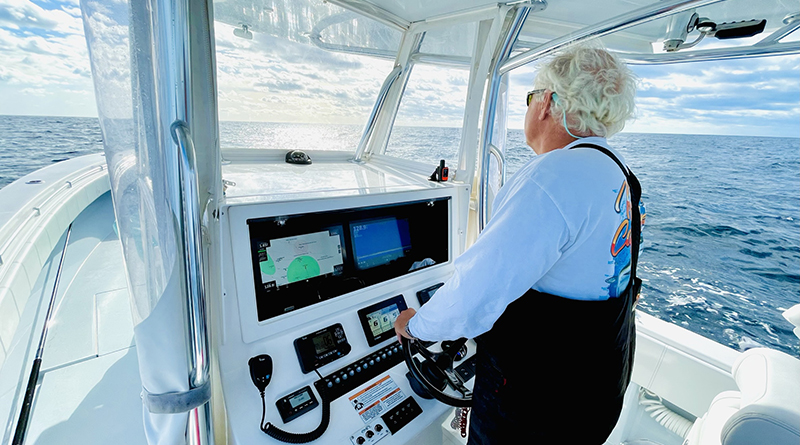
One of the key advantages of satellite-based systems is their ability to deliver consistent coverage far beyond the limits of cellular networks. As Geoff Leech, Senior Director of Marine Services for SiriusXM Marine, explains, “The SiriusXM Marine service delivers weather, fishing and entertainment directly to the boat’s multifunction display via the SiriusXM satellites. This allows boaters to navigate while simultaneously viewing up-to-date information on screen. There is no need to hold a smartphone or rely on cellular or internet signal. The SiriusXM Marine data is delivered by the same satellites that provide radio to over 30 million Americans.”
While offshore boating has always required a higher level of awareness and self-reliance, advances in satellite technology are reshaping what’s possible. Today, systems designed specifically for marine use allow boaters to receive continuously updated weather forecasts, track changing conditions, and access critical information even when far beyond the reach of cell towers.
This level of access isn’t simply about convenience. Offshore environments can change quickly, and having reliable, real-time data can play an important role in decision-making. Weather windows, sea state, and wind shifts are all factors that influence everything from fishing success to overall safety.
For offshore anglers and cruisers, the value of that data becomes even more apparent once they move beyond cell range. Leech notes that “SiriusXM Marine provides marine-specific weather data including animated weather radar, lightning, marine warnings, buoy data, NOAA marine zone reports, wind, wave and more.” He adds that for anglers in particular, “the SiriusXM Fish Mapping service delivers useful data for targeting pelagic species like sea surface temperatures, plankton, and oceanographer-generated fish recommendations.”
At the same time, connectivity offshore isn’t limited to navigation and forecasting. For many boaters, particularly those on extended trips or multi-day runs, maintaining a connection to information and entertainment has become part of the modern offshore experience. Satellite-based services can provide everything from marine weather overlays to audio programming, helping bridge the gap between isolation and awareness.
The difference between real-time satellite data and traditional forecasting is another factor shaping how boaters operate offshore. While pre-trip planning remains essential, conditions on the water often evolve in ways that forecasts alone cannot fully capture. As Leech explains, “Anyone boating should be checking weather in advance and pre-trip forecasting. When on the water, SiriusXM’s weather data provides unmatched situational awareness.”
For Southern California anglers making long runs to offshore banks, tuna grounds, or even farther destinations, this technology has become increasingly relevant. The ability to monitor conditions while underway, rather than relying solely on pre-departure forecasts, adds a layer of confidence that wasn’t always available in the past.
That confidence is rooted in a clearer understanding of what lies ahead. Leech emphasizes how satellite connectivity changes the way captains interpret and respond to offshore conditions. “Satellite-delivered weather allows boaters to have full situational awareness while out on the water,” he said. “Looking at the sky or relying on traditional radar will not provide a full picture of a storm. In these scenarios, boaters have no knowledge of the breadth, depth, direction or intensity of a storm system.”
He continued by noting how access to detailed data can directly influence decision-making offshore. “Conversely, SiriusXM weather allows you to view developing storms and even provides visible and audible warnings that alert boaters of impending storms approaching. Knowing what lies ahead instills a sense of confidence in captains and allows them to shift course to avoid impending weather, come back to shore, or at least be prepared.”
For many experienced boaters, that level of awareness can make a measurable difference. “Anyone who has been boating long enough knows that all too often weather conditions change on the water without warning,” Leech added. “Just one storm averted with this service makes it well worth the subscription cost.” He also pointed out that for seasonal users, the service includes a “Seasonal Suspend” option, allowing subscriptions to be paused without additional fees when boats are not in use.
Still, the broader lesson for boaters isn’t just about adopting new technology, but understanding its role. Offshore connectivity doesn’t replace seamanship or preparation. It complements it. Knowing how to interpret weather data, plan routes, and respond to changing conditions remains essential, regardless of how advanced onboard systems may be.
As more boaters push farther offshore in pursuit of fishing opportunities, exploration, or extended cruising, the conversation around connectivity continues to evolve. The modern offshore experience is no longer defined solely by distance from land, but by how well-equipped boaters are to stay informed, adaptable, and aware while operating in environments where traditional communication simply no longer applies.
In that sense, the real takeaway isn’t just about staying connected. It’s about understanding what connection means when the shoreline disappears, and how the right tools can help bridge that gap.