Modern offshore fishing has moved far beyond hunches and binoculars. In today’s fast-evolving marine landscape, anglers and captains rely on satellite technology and real-time environmental data to guide their offshore strategy. One of the most transformative tools in this space is fish mapping, a process that uses oceanographic analysis to predict where fish are most likely to gather. For both recreational and commercial fishermen, this approach can mean the difference between a long, fruitless day at sea and a successful haul.
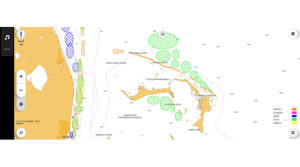
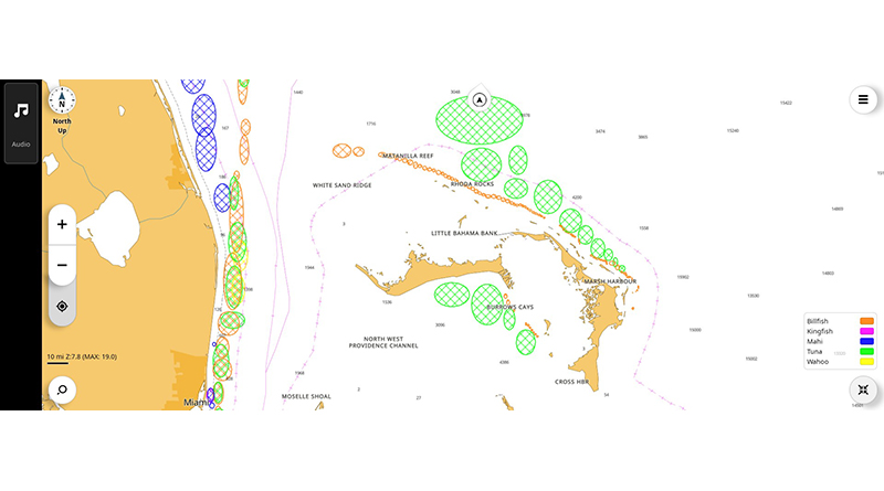
At its core, fish mapping draws from satellite imagery to interpret key environmental factors such as sea surface temperature, chlorophyll levels, water color, subsurface temperature gradients, and sea surface height anomalies. By layering this data and pairing it with biological knowledge of species-specific behavior, like the preferred temperature range of yellowfin tuna or the migratory patterns of marlin, fish mapping software can create visual “fish zones.” These are predictive areas where conditions align with the tendencies of specific species, essentially telling anglers where to look before they even leave the harbor.
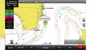
Lauren Latona of SiriusXM Marine explains that from a user’s perspective, Fish Mapping delivers “a suite of fishing data layers right to their compatible MFD, all via satellite.” Once the system is activated, users can overlay their nav screen with features like sea surface temperature contours, weed lines, subsurface temperature fronts, plankton concentrations, and even fishing recommendations for species such as tuna, marlin, swordfish, and mahi.
“Anglers use this data to identify likely areas to fish before ever putting lines in the water,” said Latona. “If they see a very strong plankton front crossed with a very strong temp front, they may head there. Or, if they see a fishing recommendation color-coded oval for tuna, they may decide to head there with confidence, knowing that ocean conditions are favorable for finding fish.”
This technology is now widely used across the fishing community. Recreational anglers rely on it to increase their odds of finding productive water, while charter captains use it to maximize client satisfaction and reduce wasted time. Commercial vessels, concerned with both efficiency and fuel costs, are particularly invested in these tools as a means to locate dense bait concentrations or optimize travel paths to high-yield waters. Companies like FishDope, Terrafin, and SiriusXM Fish Mapping have emerged as trusted providers of these insights, each delivering the data through apps, onboard systems, or mobile devices.
SiriusXM, for example, integrates fish mapping into its broader suite of marine weather services, making it accessible directly through compatible chartplotters on the helm. As Latona explains, Fish Mapping is compatible with leading marine electronics brands including Garmin, Furuno, Simrad, Lowrance, and Raymarine.
“The setup process is simple,” she said. “Install the SiriusXM Weather receiver, like the Garmin GXM54 or equivalent, and connect it to the chartplotter. Activate a Fish Mapping subscription through SiriusXM. Customize your overlays on your MFD; you can toggle layers like SST, plankton fronts, and fishing recommendations individually to match your target species.”
While traditional sonar and fish finders remain vital tools for seeing what’s directly below the boat, they serve a different purpose than fish mapping. “A conventional fish finder tells you what’s below the boat, right now. Fish Mapping helps you decide where to go in the first place,” Latona said. “Fish Mapping is strategic; it shows the high-level environmental conditions that pelagic species prefer. Once you’re in a target area, a traditional sonar or fish finder helps you fine-tune by showing bait, structure, and fish below the boat. This combination is incredibly effective offshore.”
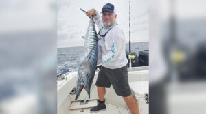
But simply having the data isn’t enough. Knowing how to apply it is where offshore strategy comes into play. Developing a sound offshore plan begins with target species selection. Each species behaves differently and thrives in specific conditions. Yellowfin tuna, for instance, tend to favor warmer blue water between 68 and 74 degrees Fahrenheit, often traveling with dolphin pods or schooling under bird piles. A strategic approach for yellowfin might involve trolling with cedar plugs or feathers, and then switching to live bait once the school is located. On the other hand, bluefin tuna prefer slightly cooler, cleaner green water and are frequently found near current edges. These fish often require kite fishing with live mackerel or flying fish to trigger a bite.
Dorado, or mahi-mahi, are known for hanging around kelp paddies and floating debris in 72 to 78-degree water. Anglers typically troll to find them, then shift to live bait or chunking once a school is spotted. Yellowtail may also be found beneath offshore kelp, often between 65 and 72 degrees, and are best targeted by fly-lining sardines or vertical jigging with irons. Striped marlin, favoring clean blue water in the low 70s, respond well to rigged ballyhoo or teasers and often announce themselves by jumping or tailing on the surface. Swordfish, meanwhile, require deep-drop tactics using squid on heavy gear — typically in deeper water over drop-offs or underwater shelves.
Planning an effective offshore trip using fish mapping tools begins with reviewing satellite data. Most services provide daily updates to sea surface temperature and chlorophyll charts, which help identify feeding grounds. From there, anglers can overlay additional layers such as sea surface height anomalies, current direction, and thermocline depth to refine their target zones. This information can be cross-referenced with known fishing banks and historical hot spots like Tanner Bank, The 209, or areas off Catalina Island.
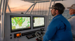
Once promising areas are identified, boaters develop a route — usually a drift or trolling path that covers two or three zones of interest. It’s important to share the plan with the crew and match it to fuel range and weather windows. Timing also plays a role in offshore success, with many species responding to specific tides, moon phases, or early morning bite windows. As conditions change throughout the day, many anglers adjust their route based on VHF reports, visual cues like bird piles, or real-time satellite updates received onboard through services like SiriusXM Marine.
Gear and presentation complete the picture. Depending on species, anglers may employ trolling lures, live bait fly-lining, kite rigs, or chunking techniques. Drift speed, hook size, and bait type can all be adjusted based on real-time behavior. While sonar and binoculars are still essential tools, they’re now supported by an ecosystem of data-driven insights that make every move more intentional.
Ultimately, fish mapping and offshore planning are about maximizing time, fuel, and opportunity. They reduce blind searching, improve catch efficiency, and support more sustainable fishing by allowing anglers to target fish more precisely without placing undue pressure on random areas of the ocean.
Latona agrees, noting that Fish Mapping “uses oceanographic data to help locate areas with the right temperature, plankton, and oceanic convergence zones that attract bait.” She adds that the system is backed by oceanographers and satellite analysis, making it a powerful tool to “identify where pelagic species are likely to be feeding.”
As this technology continues to evolve, offshore fishing is poised to become even more efficient, informed, and environmentally conscious. For the angler willing to study the data, understand species behavior, and fine-tune their strategy accordingly, fish mapping has become not just an advantage — it’s an essential part of the toolkit.