Marine navigation platform is being built around vessel-specific routing, community reports and trip planning, with Co-Captain and HelmLink concepts intended to connect the boat, boater and conditions in one ecosystem.
For Southern California boaters, planning a day on the water can mean checking one source for the marine forecast, another for waves, a chart for depths and hazards, Automatic Identification System (AIS) for vessel traffic, Coast Guard notices for navigational information and perhaps a text from someone who was offshore the day before.
Anglers can add another round of questions before ever leaving the dock. What are conditions doing offshore? Where have fish been showing? What did other anglers encounter that morning?
Lucas Wright, founder of PATHR, believes the problem is not that boaters lack information. It’s that the information they need is scattered across too many places.
“The funny thing is that boating doesn’t really suffer from a lack of information,” Wright said. “It suffers from information being everywhere.”
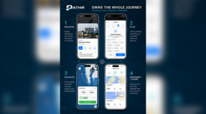
PATHR is being developed to bring more of that decision-making process into a single marine platform. The system combines navigation and vessel-specific routing with depth information, weather, waves, AIS traffic, marine hazards, Coast Guard information, destination discovery, harbor reviews and community reports.
But according to Wright, simply putting several existing tools under one roof is not the ultimate goal.
“The biggest advantage of putting everything together isn’t convenience. It’s context,” Wright said.
That context begins with something more personal than choosing a destination: the boat itself and the person operating it.
Before PATHR generates a route, Wright said the platform learns characteristics including the vessel’s draft and mast height, along with the operator’s preferences. Those can include how far offshore the captain is comfortable traveling, how much shallow-water margin is preferred and, as the system develops, what weather and sea conditions the operator considers appropriate for the boat and his or her experience.
“One of the fundamental ideas behind PATHR is that there is no such thing as one universally correct boating route,” Wright said.
A route appropriate for an 18-foot center console drawing 2 feet, for example, may be unsuitable for a sailboat drawing 6 feet with a 60-foot mast. Even two captains aboard identical boats might make different choices based on experience and comfort.
PATHR is intended to account for those differences.
Once a destination is selected, the system generates a vessel-specific route using charted depths and known obstacles. Wright said routing is being designed to consider shallow water, shoals, jetties, docks, buoys and other navigational hazards rather than simply calculating the shortest line between two points.
The platform’s Route Safety score is intended to make some of those considerations easier for an operator to interpret, but Wright emphasized that the score should not be mistaken for a declaration that a voyage is safe.
“A Route Safety score should never be interpreted as PATHR declaring that a voyage is safe,” Wright said. “The captain is still the captain.”
That distinction is important. Charts have limitations, weather can change, floating hazards can appear and aids to navigation can move. Wright said PATHR’s objective is not to replace judgment, but to provide captains with better information about where risk may exist and why one route might provide more margin than another.
“The goal isn’t to remove judgment from boating,” he said. “It’s to give boaters much better information with which to exercise that judgment.”
For Wright, the experience also begins before a captain necessarily knows where he or she wants to go.
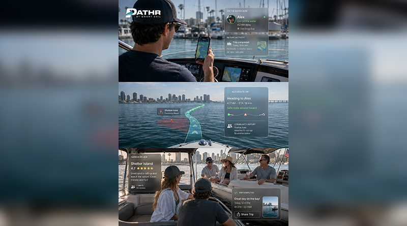
PATHR incorporates a discovery component where boaters can explore harbors and destinations, read information shared by other users and decide where they want to spend the day. Once a destination is selected and a route generated, Wright envisions another layer of information coming from PATHR’s developing Co-Captain feature.
Co-Captain is intended to examine the entire trip before departure, bringing the route together with relevant weather, waves and marine hazards while comparing those conditions with the vessel and the operator’s preferences. Wright said the system is also being designed to incorporate Coast Guard information, including Notices to Mariners and port restrictions, along with reports submitted by PATHR users.
A boater ahead of you might, for example, report floating debris or waves that are considerably larger than forecast.
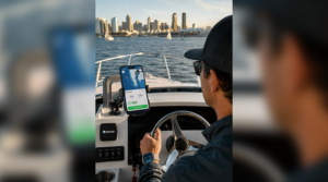
Rather than requiring the captain to interpret each piece of information independently, Wright described the resulting experience as a “preflight briefing for boating.”
“What does all of this mean for my boat, my route and my trip today?” Wright said, describing the question PATHR ultimately wants the system to help answer.
That is where Wright sees Co-Captain becoming considerably different from simply displaying more information on a chart.
Before departure, a future briefing could identify that a route provides sufficient depth for the vessel while also noting that winds are expected to increase on the return trip, a Coast Guard notice affects part of the route or boaters already offshore are reporting conditions different from the forecast.
Underway, the concept is for Co-Captain to continue monitoring relevant information. If weather changes or another user reports a new hazard, PATHR could bring that change to the operator’s attention in relation to the trip already underway.
“So the vision isn’t really an AI chatbot for boaters,” Wright said. “It’s much larger than that.”
The captain, he emphasized, remains in control.
“We’re just trying to give that captain the kind of information, preparation and second set of eyes that historically came only with years and years of experience on the water,” Wright said.
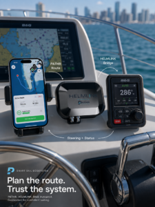
Another developing component, HelmLink, is intended to connect that modern planning experience with equipment boaters may already have aboard.
Wright said PATHR is not being designed around the assumption that boat owners should replace thousands of dollars in functioning marine electronics to use the platform. The goal with HelmLink is for a route planned and reviewed through PATHR to eventually transfer to compatible existing chartplotters and autopilots, including older equipment, rather than requiring the boater to manually recreate the route at the helm.
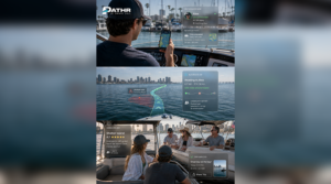
That connection also could create additional possibilities as the network grows. Wright said data collected by connected vessels could eventually contribute real-world depth measurements that improve knowledge of local bathymetry, or underwater terrain, while onboard weather observations could contribute to increasingly localized information about conditions.
Bathymetry also plays into PATHR’s anchoring plans. Wright said the platform is being developed to combine underwater terrain and expected depth with information about a boater’s anchoring setup to help an operator evaluate an anchorage and determine appropriate scope and equipment. An anchor-watch function could then help monitor the boat after it’s set.
For Southern California anglers, however, some of PATHR’s most interesting potential may come from what other boaters are seeing on the water.
Wright said the company wants anglers to eventually be able to mark catches on the map, identify species and decide what information to share with the PATHR community. As those reports accumulate, the platform could begin identifying patterns in where fish are being caught and how activity changes with location, season and conditions.
An angler could eventually open PATHR not only to ask how to navigate to an offshore area, but also where other users have recently encountered yellowtail, what conditions boaters are reporting there and whether anything has changed since earlier that morning.
“The more people who contribute, whether they’re reporting hazards, reviewing harbors, sharing conditions or logging catches, the more useful PATHR becomes for the next boater heading out,” Wright said.
Southern California is serving as PATHR’s starting point and proving ground. Wright said the region was selected because it’s home to the team and its boating community, which gives the company an opportunity to put the platform on real boats and learn from everyday use.
The concept, however, is intended to extend beyond local waters.
Shallow and complicated waterways in places such as Florida could put particular emphasis on vessel-specific depth routing, while destination information and community reports could become increasingly useful to cruisers exploring unfamiliar harbors.
“We really don’t see PATHR as a Southern California product,” Wright said. “We see it becoming a global boating platform.”
For a Southern California boater, though, the concept is easy to picture closer to home.
A captain planning a trip to Catalina could explore the destination, create a route based on the vessel’s draft and preferences, review weather and waves, check marine and community reports and eventually receive a Co-Captain briefing before departure. With HelmLink, the longer-term vision is for that same reviewed route to move onto compatible onboard electronics without being rebuilt manually.
For an offshore angler, the equation could add catch reports and fishing patterns. For a cruiser arriving at an unfamiliar anchorage, it could add bathymetry, anchoring information and reports from boaters already there.
Wright said that ability to personalize the experience is central to where he believes marine technology is heading.
“Two boats going to the same place may require completely different routes, and two captains operating the same boat may have very different comfort levels,” Wright said. “PATHR is being built to understand both the boat and the boater.”
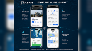
Ultimately, PATHR’s “one app instead of five” concept is less about reducing the number of icons on a boater’s phone and more about making the information behind those icons work together.
A forecast is one piece of data. Draft is another. A Coast Guard notice, a depth contour and a boater reporting debris are others. PATHR’s larger ambition is to understand how those pieces relate to a particular vessel, captain and trip.
“Not simply giving everyone more information,” Wright said, “but giving each captain the information that matters to them, on their boat, for the trip they’re taking right now.”
And despite the technology being developed around that captain, Wright repeatedly returns to one distinction.
The app can help plan the route. It can organize information, flag changing conditions and provide another set of digital eyes. It may eventually connect the plan directly to the electronics at the helm.
But the person sitting at that helm remains responsible for the boat.
As Wright put it, “The captain is still the captain.”
For more information, visit getpathr.com.