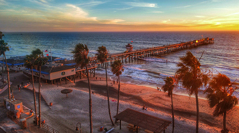
A small phone cradle mounted along the railing of the San Clemente Pier is now playing a major role in tracking beach changes — thanks to the launch of a new CoastSnap station. While it may appear to be a simple tool for tourists, the cradle is part of a global citizen-science project that invites the public to help researchers monitor shoreline changes through time-stamped photos.
CoastSnap, which began in Australia at the University of New South Wales, uses community-submitted photographs to monitor how beaches erode, recover, and shift in response to seasonal patterns, storms, sea-level rise, and human activity. The fixed cradle ensures all images are taken from the same angle and position, allowing scientists to apply a technique called photogrammetry to extract accurate shoreline data from each photo. These images are then geo-rectified and used to track the precise position of the coastline over time, which provides insight into beach width and erosion rates.
San Clemente’s addition to the CoastSnap network comes as part of a broader effort to expand the program along the California coast. The California rollout is led by UC Santa Barbara’s Marine Science Institute and is funded through a grant from the state’s Ocean Protection Council. San Clemente is now one of six active stations in the state, joining other locations from Mendocino County to San Diego.
The San Clemente project came together through a local collaboration that included the grassroots organization Save Our Beaches San Clemente, the San Clemente Woman’s Club, and the City of San Clemente. The Woman’s Club provided funding for the informational sign and research support, while city staff managed the installation of the cradle and signage on the pier—despite some logistical challenges posed by the angled railings.
To participate, visitors simply place their smartphone into the cradle, take a photo without using zoom or filters, and scan the accompanying QR code. This directs users to the CoastSnap website or app, where they can upload their image along with the time and date. The process is designed to be intuitive, and local advocates plan to provide additional instructions online to help older residents navigate the technology.
The real power of CoastSnap lies in the accumulation of repeat photos taken from the same spot. The more images collected, the stronger the dataset becomes, allowing researchers to build a clear, time-lapse record of coastal changes. Over time, these visual records help scientists and policymakers understand how local beaches respond to storm events, seasonal changes, and restoration projects like sand replenishment.
In San Clemente, this information is particularly valuable. The city has long grappled with coastal erosion and beach management, making consistent, community-driven data a helpful tool for shaping future decisions. In addition to its scientific utility, CoastSnap offers the public a tangible way to engage with local coastal issues and develop a deeper understanding of how the shoreline evolves naturally.
Across the state and beyond, CoastSnap stations are helping bridge the gap between scientific research and public awareness. By transforming casual smartphone photos into reliable scientific data, the project invites everyone, from weekend visitors to lifelong residents, to take part in preserving and understanding their local coastline.
For San Clemente, the addition of CoastSnap is not only a step forward in coastal research but also a testament to what local partnerships can achieve. Residents and tourists alike are now encouraged to visit the pier, snap a photo, and contribute to a growing body of knowledge that’s shaping the future of shoreline science — one picture at a time.