")
For generations, boating safety has depended on what mariners could see, hear, and predict using experience, intuition, and local knowledge. Weather forecasts were often generalized, navigation hazards were static, and decision-making relied heavily on radio range and proximity to shore. Today, that model is changing rapidly, driven by the expanding role of satellite-delivered data in recreational and commercial boating.
Satellite technology is no longer reserved for bluewater passagemaking or large commercial vessels. It’s become an increasingly important safety tool for everyday boaters, providing real-time access to weather systems, sea state data, vessel information, and situational awareness far beyond the reach of traditional shore-based infrastructure. As satellite coverage improves and data delivery becomes more precise, the ability to plan, adapt, and respond on the water has fundamentally shifted.
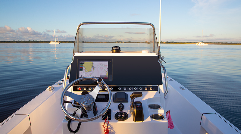
One of the most significant advances comes in the form of weather intelligence. Strategic planning before heading offshore is now less reliant on guesswork and more rooted in continuous, data-driven awareness. According to the SiriusXM Marine team, “Strategic planning when heading offshore is critical. SiriusXM Marine weather services provide this capability by delivering regularly updated marine weather data directly to a boat’s multifunction display via satellite, providing coverage well beyond cellular range — up to 150NM offshore.”
That extended coverage allows boaters to make informed decisions long before lines are cast off. “Before leaving the dock,” the team explains, “boaters can review detailed forecasts, high-resolution weather radar, wind data, wave heights, and storm cell attributes to assess overall conditions and plan routes accordingly while making a go/no-go decision.” This pre-departure insight has become especially valuable along the West Coast, where localized weather patterns and offshore systems can change conditions quickly.
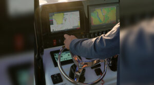
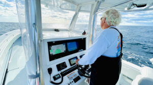
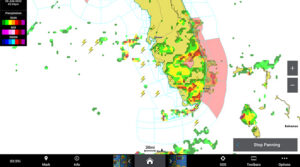
Once underway, the advantage of satellite-delivered data becomes even more pronounced. Continuous updates provide what the SiriusXM Marine team describes as critical situational awareness, allowing captains to monitor developing systems in real time. Rather than relying solely on onboard radar, which typically shows only the immediate outline of a storm, satellite data offers a broader perspective. “Instead of relying on onboard radar, which only shows the basic outline of a storm, they can see a bird’s eye view of storm cells, lightning activity, wind shifts, and more, allowing them to reroute, adjust speed, or seek shelter proactively.”
This ability to see beyond the horizon fundamentally changes how boaters interact with weather. The team notes that the result is “greater confidence and more informed decision-making from departure to return,” particularly for offshore anglers, cruisers, and sailors who may be hours from safe harbor.
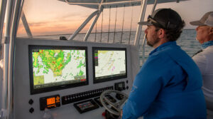
Certain satellite-delivered features have emerged as especially influential in real-world safety scenarios. SiriusXM Marine points to a combination of tools working together rather than a single solution. “Several features stand out for their impact on helping boaters stay informed on the water,” they explain, beginning with high-resolution weather radar that “provides detailed precipitation data to help boaters track storm intensity and movement.” Lightning detection adds another layer of protection by offering strike data that is “critical for avoiding dangerous convective activity.”
Storm cell attributes further enhance planning by displaying projected direction, speed, and intensity, helping captains anticipate where conditions are headed rather than reacting after they arrive. Surface wind and wave data support more strategic and comfortable routing decisions, while marine warnings deliver alerts directly to the boat’s display when hazardous conditions are present. Together, these tools transform raw weather data into actionable intelligence at the helm.
The importance of satellite delivery becomes even clearer when compared to cellular-based information. While mobile connectivity has improved near shore, it remains limited and unreliable offshore. As the SiriusXM Marine team explains, “Cellular coverage is limited and can be unreliable even a few miles offshore. Satellite delivery ensures data far beyond coastal cell range — up to 150 NM offshore from the contiguous US.”
That continuity is critical in offshore environments, where weather systems can develop rapidly and assistance may be far away. “With satellite data,” the team adds, “captains aren’t dependent on downloading updates before departure or hoping for intermittent connectivity. Instead, they receive regularly updated information throughout the voyage, helping to improve decision-making.” In practical terms, this represents a shift in boating culture itself. “Rather than discovering deteriorating conditions after they arrive, boaters can see changes unfolding,” moving safety from reactive to proactive.
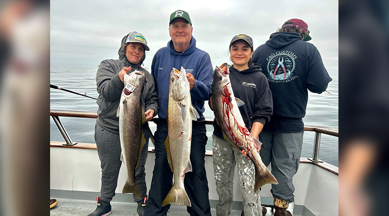
Real-world application often illustrates this shift most clearly. The SiriusXM Marine team points to offshore anglers who rely on these tools daily, including Capt. Gordie of Team Lucky Strike. “With SiriusXM, you can see past the thunderstorm,” Capt. Gordie explains. “It shows you the movement over the last hour, not just where the storm is, but where it’s going.” For crews fishing far offshore, that historical context can be the difference between continuing safely and making an early exit.
Capt. Gordie highlights the value of understanding storm speed and trajectory. “When you’re offshore and see weather 40 miles away, you can tell how fast it’s moving and know you’ve got plenty of time.” He also emphasizes the importance of automated alerts. “What’s really cool is the weather warning feature. You can set the system to trigger an alarm if something changes, so you’re not guessing — you know you’re safe.” That confidence allows crews to focus on the experience itself. “It lets us enjoy the day, keep fishing, and make smart calls when it’s time to move.”
Looking ahead, satellite marine technology is expected to become even more predictive and precise. The SiriusXM Marine team points to rapid advancements in forecasting models and artificial intelligence. “Technology is advancing the capabilities of weather forecasting and AI generated models are improving the ability to generate hyper local predictions, as well as, the accuracy of regional weather conditions.”
Through its weather data partners, SiriusXM Marine says it will continue integrating these advancements into its services, with the goal of giving boaters clearer insight into what lies ahead. “SiriusXM, through their weather data partners, will continue to incorporate these advancements for the benefit of service users, making boaters more aware of conditions ahead, so they can fully enjoy their time on the water.”
As satellite data becomes increasingly integrated with chartplotters, multifunction displays, and onboard electronics, its influence on boating safety will continue to expand. What once required multiple devices and fragmented sources is now delivered through unified systems designed for real-time decision-making. In doing so, satellite technology is not replacing seamanship — it’s strengthening it, giving boaters the information they need to make safer, smarter choices wherever their routes may lead.