Editor’s Note: This article was updated on June 24, 2026, to clarify the location of the San Juan Creek Ocean Outfall and revise language regarding navigation and water quality. The clarifications were made based on information provided by Chad Wanke of the South Orange County Wastewater Authority (SOCWA), a Joint Powers Authority responsible for wastewater collection, treatment, recycling and disposal services supporting more than 500,000 residents and businesses across South Orange County.
Every harbor has its secrets. In Dana Point, one of the most talked-about, quietly fished and occasionally debated spots sits offshore, where anglers have long targeted an area associated with the San Juan Creek Ocean Outfall.
Locals simply call it “the pipe.”
At first glance, it does not look like much. There is no dramatic structure breaking the surface, no kelp line waving in the swell and no obvious indicator that the area should hold fish. But beneath the surface, changing currents and feeding conditions can create opportunities that draw a variety of species.
For anglers who understand how to read the area, the pipe has earned a reputation as a productive fishing zone off Dana Point.
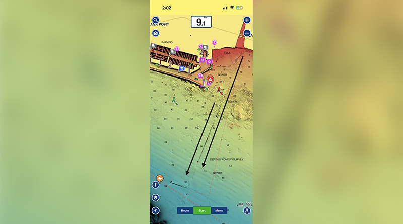
The treated-water outfall is located approximately 2.2 miles offshore from Doheny State Beach in about 100 feet of water. Anglers fishing the area are generally targeting surrounding current lines and feeding zones rather than the outfall structure itself.
Calico bass are among the species anglers may encounter, along with sand bass and halibut. Every so often, particularly during the right season and conditions, there is also the possibility of a white seabass moving through the area.
It is not a guarantee, but it is enough to keep anglers coming back.
Fishing the area effectively starts with understanding positioning. Rather than focusing on the physical outfall structure, anglers can look for changes in current, water movement and other conditions that may concentrate bait and create feeding opportunities.
Boat positioning becomes key. Ideally, anglers will set up a drift that allows their bait or lure to move naturally with the current and through areas where fish may be feeding. Too much throttle or constant repositioning can disrupt the presentation. Letting the water do the work often produces better results.
For those fishing from smaller vessels or kayaks, maintaining a controlled drift can be the difference between a quiet day and a productive one. Subtle adjustments, rather than aggressive movements, tend to keep presentations in the zone longer.
Tides can also play a role in how the area fishes. Stronger tidal exchanges may produce more defined current lines, while changing conditions can affect where bait and predatory fish concentrate.
Timing those tidal windows, especially when they coincide with early morning or late afternoon light, may improve an angler’s chances of finding active fish.
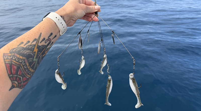
When it comes to bait and tackle, versatility is an advantage. Swimbaits are a staple for many local anglers, particularly in natural baitfish patterns that match the forage in the area. Soft plastics rigged on lead heads allow for controlled depth and movement, making them useful for working changing conditions.
Jigs can also be effective, especially when targeting sand bass holding closer to the bottom. A slow, steady retrieve that keeps the lure in the strike zone can produce solid bites.
For those who prefer live bait, anchovies and sardines remain reliable options. Drifting a live bait through areas of moving water can be particularly effective for halibut, which are known to strike opportunistically as bait moves past their position.
Adding scent to artificial presentations has also gained popularity among anglers. Products designed to mimic natural bait can help increase angler confidence and potentially extend the time fish hold onto a lure, giving anglers a better chance to set the hook.
While the fishing can be productive, boaters should remain aware of changing currents, vessel traffic and harbor operations, just as they would in any active coastal environment. Maintaining safe navigation practices and respecting any restricted areas helps ensure a safe and enjoyable experience on the water.
The San Juan Creek Ocean Outfall itself is located approximately 2.2 miles offshore from Doheny State Beach at a depth of about 100 feet. This clarification is important because references to fishing “the pipe” can create the impression that anglers are fishing directly over or coming into physical contact with a visible or near-surface outflow. Instead, anglers are generally fishing the broader offshore area and responding to the conditions they encounter on the water.
The pipe remains an example of how local fishing knowledge can turn a seemingly unremarkable offshore area into a regular stop for anglers. It is not a traditional fishing spot in the same sense as a visible kelp bed or rocky reef, but it has earned a place in the local fishing rotation.
For Dana Point anglers, the area offers a change of pace and an opportunity to fish relatively close to home. For visiting boaters, it provides an example of how understanding currents, bait and changing ocean conditions can help anglers identify productive water.
It also serves as a reminder that fish are drawn to conditions, not appearances. What may look unremarkable on the surface can hold life below, shaped by currents, forage and subtle environmental shifts.
In a region where fishing often involves chasing moving schools or covering large areas of water, fishing the pipe area can require a different approach. It is about patience, positioning and understanding how changing conditions can concentrate activity.
For those willing to learn its rhythms, it can deliver.
Whether it is a steady calico bite, a surprise halibut or the occasional story of a larger fish passing through, the pipe continues to prove that sometimes the best fishing spots are not the most obvious ones.
They are simply the ones that work.
Updated map graphic: Map arrows depict the general direction of the treated-water plume and do not represent the location of the actual ocean outfall pipe, which is located approximately 2.2 miles offshore from Doheny State Beach in about 100 feet of water.